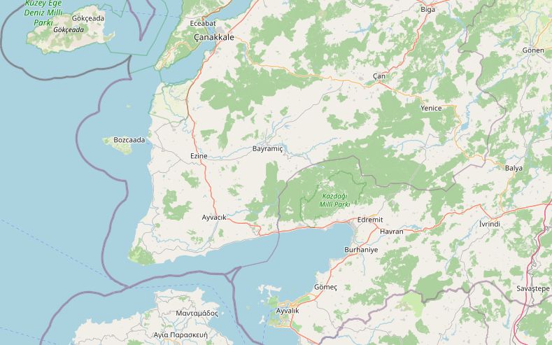
This route leaves Çanakkale on the D550 heading south and turns off to the ruins of Troy before rejoining the main road at Ezine. After Ayvacık it drops to Behramkale, the village on top of ancient Assos, and then takes the narrow road along the shore below Kazdağı (Mount Ida) to Küçükkuyu. From there the D550 follows Edremit Bay through Altınoluk and Edremit, then turns south past Burhaniye to Ayvalık.
The whole ride is 220 km and fits in one day, with time for Troy and Assos. The highest point is 305 m, in the hills around Ayvacık. Fuel is easy on the D550, but the stretch from Ayvacık through Assos and along the coast to Küçükkuyu has no station for about 49 km, so fill up before you reach Ayvacık.
Along the way
- ÇanakkaleThe wooden horse on the northern waterfront was made for the 2004 film Troy. Çimenlik Castle, built for Mehmed II in 1461–62, stands by the naval museum, which shows a full-size replica of the minelayer Nusret.
- TroyA UNESCO World Heritage Site since 1998, with ten city layers going back to about 3000 BC. The Troy Museum at the site entrance opened in 2019.
- EzineHome of Ezine cheese, made mostly from sheep and goat milk and aged for a year. In 2023 it became the first Turkish cheese registered as a geographical indication in the EU.
- Assos (Behramkale)The Temple of Athena, from about 540–530 BC, sits on a cliff high above the sea. Aristotle lived and taught here for about three years after 347 BC. The city walls run for some 3 km. Fuel up before Ayvacık: the next 49 km have no station.
- Kazdağı coastEast of Assos the road runs along the shore below Kazdağı, ancient Mount Ida, whose highest peak reaches about 1,770 m. In myth this is where Paris judged the goddesses.
- KüçükkuyuThe Adatepe Olive Oil Museum, opened in 2001 in a former soap factory, stands on the main road.
- AltınolukA summer resort on the Kazdağı foothills. Kazdağı National Park and Şahindere Canyon are close by.
- EdremitThe main town of the bay. Akçay, about 10 km west on the shore facing Lesbos, swells to many times its size in summer.
- BurhaniyeAn olive oil town. The site of ancient Adramyttium lies about 4 km to the west.
- AyvalıkFamous for its olive oil. Its Greek population was exchanged in 1923. A causeway and bridge from the late 1960s link the town to Cunda (Alibey) Island, and Şeytan Sofrası hill is the local sunset viewpoint.
Elevation profile
Green ticks mark fuel stations. Hover the chart to read the height at any point.
73 fuel stations sit within 400 m of the road. The longest stretch without one is 48.6 km, between km 84.6 and 133.2 (Ezine to Küçükkuyu). Any bike with a normal tank covers that without planning.
- 48.6 km (km 84.6–133.2)
- 26.6 km (km 37.8–64.4)
- 11.4 km (km 22.4–33.8)
Stages
| Section | km | Time |
|---|---|---|
| Day 1: Çanakkale → Ayvalık | 220.6 | 3 h 54 min |
| Çanakkale → Troy | 29.3 | 0 h 27 min |
| Troy → Ezine | 28.8 | 0 h 30 min |
| Ezine → Assos | 45.7 | 0 h 44 min |
| Assos → Kadırga | 5.6 | 0 h 11 min |
| Kadırga → Küçükkuyu | 25.4 | 0 h 38 min |
| Küçükkuyu → Edremit | 37.4 | 0 h 48 min |
| Edremit → Ayvalık | 48.4 | 0 h 36 min |
When to ride
April–May and September–October are best. July and August are hot and Edremit Bay fills with holidaymakers. Winter is quiet and often wet.
Fuel cost
Default price: Antalya petrol, 2 October 2026.
GPS track
The full route as a GPX file, for Garmin, Calimoto, Kurviger and most navigation apps.
Download GPXMeasured: 4 November 2026