Istanbul to Cappadocia via Bolu, Ankara and Lake Tuz
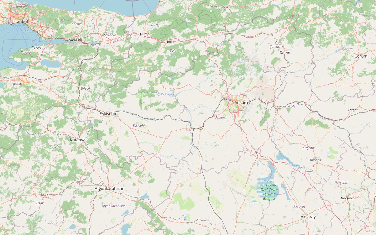
This is the main way across from Istanbul to Cappadocia. It starts on the Asian side at Üsküdar, follows the motorway east through the Bolu mountains to Ankara, then turns south across the plateau along the shore of Lake Tuz to Aksaray and Göreme.
The full 759 km can be done in two long days, but the plan below splits it into four, which leaves time for Ankara and a side trip to the Ihlara valley. Fuel is easy on this route: the longest gap between stations is about 59 km. The highest point, about 1,580 m, comes on the motorway between Bolu and Ankara. If you start on the European side, the Eurasia Tunnel under the Bosphorus has been open to motorcycles since May 2022.
Along the way
- ÜsküdarStart on the Asian shore of the Bosphorus. Morning traffic out of Istanbul is heavy; leave early.
- Mount Bolu TunnelThe motorway passes under Mount Bolu in a tunnel of just over 3 km, opened in 2007 between Kaynaşlı and Yumrukaya.
- BoluOvernight stop at the end of day one. Lake Abant, a crater lake at 1,328 m and a national park since 2022, lies 34 km south-west of the town.
- Bolu to AnkaraThe motorway crosses wooded hills and reaches about 1,580 m, the highest point of the route, before dropping towards the capital.
- AnkaraAnıtkabir, Atatürk's mausoleum on Rasattepe hill, was completed in 1953 and houses a museum of the War of Independence.
- Lake TuzSouth of Ankara the road runs beside Türkiye's second-largest lake, a shallow salt lake that supplies most of the country's salt and hosts a large flamingo colony.
- AksarayThe town has a 15th-century Ulu Mosque and the red-brick Eğri Minaret, which leans. It is also the turn for Ihlara.
- Ihlara and SelimeA side trip south of Aksaray: the Ihlara valley is a canyon 15 km long and up to 150 m deep with about 50 rock churches, and the carved Selime monastery stands at its north-west end.
- GöremeThe road crosses the plateau past Nevşehir to Göreme, the base for riding Cappadocia. See the Cappadocia valleys loop for a day ride from here.
Elevation profile
Green ticks mark fuel stations. Hover the chart to read the height at any point.
219 fuel stations sit within 400 m of the road. The longest stretch without one is 58.8 km, between km 474.4 and 533.2 (Ankara to Aksaray). Any bike with a normal tank covers that without planning.
- 58.8 km (km 474.4–533.2)
- 58.6 km (km 42.0–100.6)
- 50.0 km (km 159.2–209.2)
Stages
| Section | km | Time |
|---|---|---|
| Day 1: İstanbul → Bolu | 249.2 | 2 h 35 min |
| İstanbul → Bolu | 249.2 | 2 h 35 min |
| Day 2: Bolu → Ankara | 188.4 | 2 h 4 min |
| Bolu → Ankara | 188.4 | 2 h 4 min |
| Day 3: Ankara → Aksaray | 234.9 | 2 h 38 min |
| Ankara → Aksaray | 234.9 | 2 h 38 min |
| Day 4: Aksaray → Göreme | 86.9 | 1 h 10 min |
| Aksaray → Göreme | 86.9 | 1 h 10 min |
When to ride
Spring and autumn are best. The Bolu mountains and the Anatolian plateau are cold in winter, and summer afternoons on the plateau are hot and exposed.
Fuel cost
Default price: Antalya petrol, 2 October 2026.
GPS track
The full route as a GPX file, for Garmin, Calimoto, Kurviger and most navigation apps.
Download GPXMeasured: 2 November 2026